

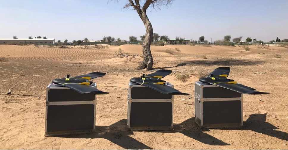
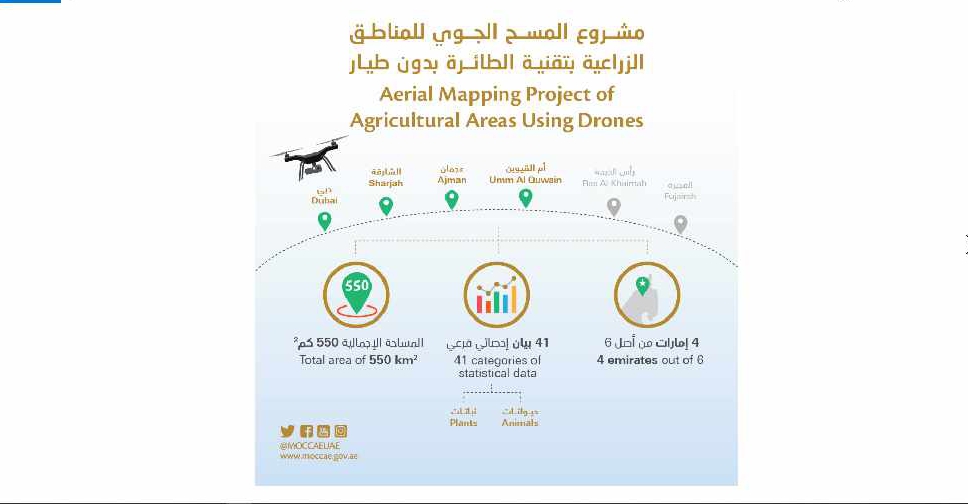
A project to map agricultural areas in the UAE using drones has completed its first phase.
It’s captured around 550 square kilometres of land across Dubai, Sharjah, Ajman, and Umm Al Quwain so far.
The Ministry of Climate Change and Environment will use the data to monitor crops and help farmers with forward planning.
Agricultural areas in Fujairah and Ras Al Khaimah will be mapped in the project's second phase later this year.

 UAE modifies alert sounds in National Early Warning System
 2 members of UAE Armed Forces martyred in helicopter crash
 UAE participates in extraordinary EU–GCC leaders meeting
 Spanish PM reaffirms support for UAE following Iranian attacks
 UAE welcomes US listing of Sudanese Muslim Brotherhood as terrorist group
 UAE ambassador to UN calls for 'de-escalation' in Iran conflict
 Dubai ranked world’s cleanest city for sixth consecutive year
 Indian education board CBSE postpones Class 12 exams until March 16