

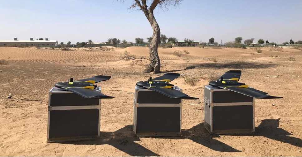
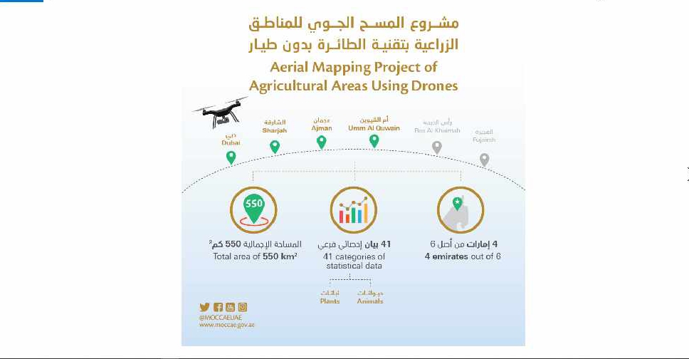
A project to map agricultural areas in the UAE using drones has completed its first phase.
It’s captured around 550 square kilometres of land across Dubai, Sharjah, Ajman, and Umm Al Quwain so far.
The Ministry of Climate Change and Environment will use the data to monitor crops and help farmers with forward planning.
Agricultural areas in Fujairah and Ras Al Khaimah will be mapped in the project's second phase later this year.

 Dubai sets up media committee to counter fake news, misinformation
 UAE marks 1,000 days of humanitarian mission supporting Gaza
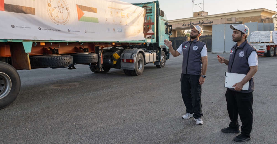 UAE continues to send more aid convoys to Gaza
 UAE and Kuwait foreign ministers discuss regional developments
 UAE President, Zelenskyy discuss Ukraine crisis and bilateral ties
 H.H. Sheikh Hamdan approves supervisory committee supporting families
 RTA says public transport, taxi use hits nearly 350 million in 2026
 UAE condemns Iranian attack on Kuwait